
Analytics, Education and Science, Latvia, Society
International Internet Magazine. Baltic States news & analytics
Monday, 20.04.2026, 04:42
Population with higher level of education focus in densely populated areas in Latvia
 Print version
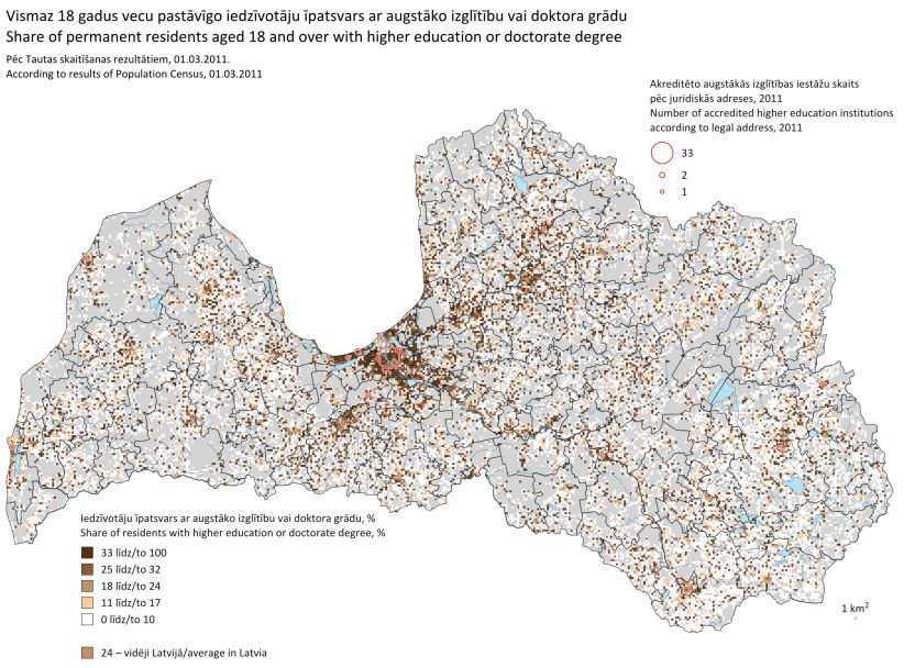
Data of Population Census 2011 witness that in Latvia territories with typically high share of population with higher education or PhD are in Rīga and Pierīga region, Jelgava, Cēsis and in the surrounding area, near Talsi and Kuldīga.
The lowest value means that population living in the respective territorial unit have lower level of education, the highest value – highest level of education.
In Latvia average study index is 0.6, which corresponds to 13.2 years of studying. For comparison – 12 years are needed to obtain general secondary education. Basing on data depicted in the chart, it can be concluded that population with higher level of education focus in densely populated areas.
Average study period index is typically high in Rīga and Pierīga region, Cēsis, Valmiera, Daugavpils and Rēzekne. But typically low indicator is in a large part of Latgale region and in some places at Lithuania, Russia and Belarus border.
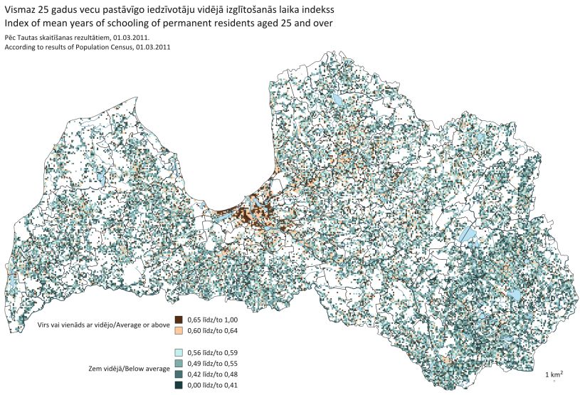
Average study period of population in the territory depends not only on the existence of educational institutions, but also on the demand for labour force, development of infrastructure, availability of services. It must be mentioned that not always higher average study period witnesses on that this territory has larger share of population with higher education.
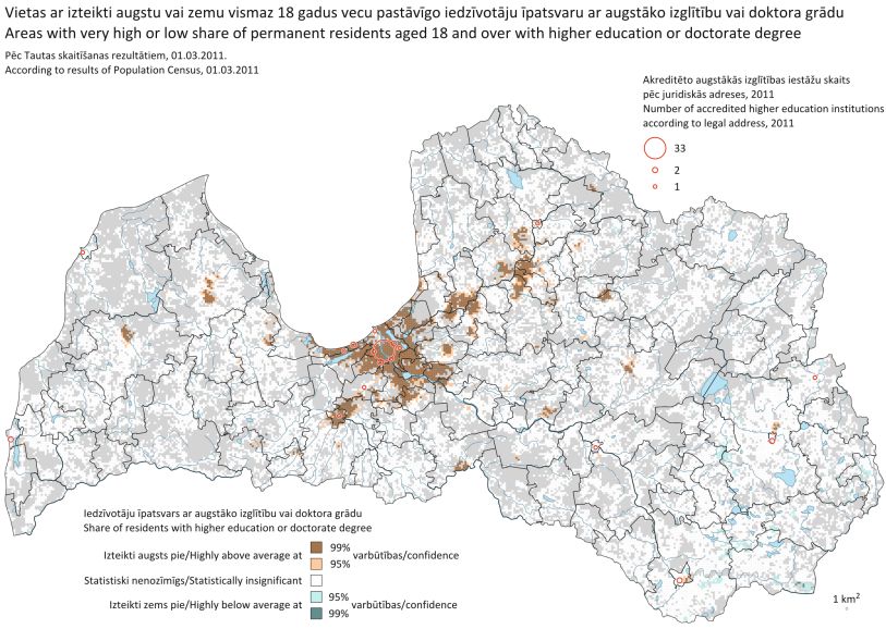
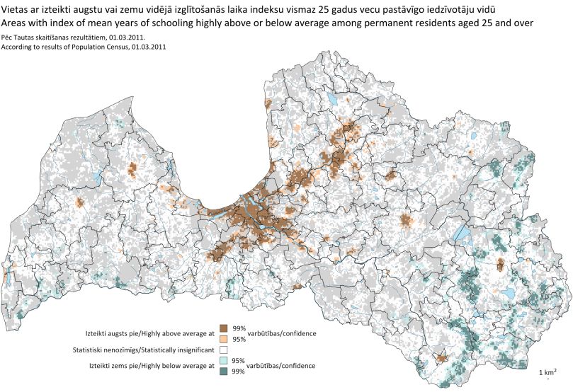
To determine territories with typically high or low share of population with higher education and average study period index, Getis-Ord Gi* spatial statistics method was used.
Concluding current processing stage of data obtained in Population Census 2011 and linking housing addresses to coordinates, CSB offers spatial development planning specialists, researchers, students and other data users with opportunity to obtain spatial information on the population of Latvia, according to Population Census Programme. Data are depicted in grid map with cell size 1x1 km2. Territory of Latvia is broken down in 65.6 thsd cells, of which 33 thsd grid cells are populated.
Maps and grid data for spatial analysis of statistical information and creation of maps by own efforts are published in the CSB homepage in section "Data visualization".


 «The Baltic Course» Is Sold and Stays in Business!