
Analytics, Demography, Latvia, Society
International Internet Magazine. Baltic States news & analytics
Friday, 26.04.2024, 05:21
Most densely populated territory in Latvia is Riga Pļavnieki neighbourhood
 Print version
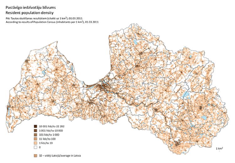
Data obtained in Population Census are depicted in a grid map with cell size 1x1 km2. Territory of Latvia is broken down in 65.6 thsd cells, of which 33 thsd grid cells are populated – in Population Census 2011 resident population was counted in this territory.
Most densely populated territory is Riga Pļavnieki neighbourhood, where 22 282 resident population was counted in one grid cell. But in two thirds (21 thsd) of populated grid cells 10 or even less persons were counted.
Population Census data and maps for spatial analysis of statistical information are published in the CSB homepage in population census section "Data visualization". At the moment population density and most widely used languages grid maps are published, as well as grid data on population density for spatial analysis and drawing maps on one's own.


 «The Baltic Course» Is Sold and Stays in Business!